Laptops are dead. The trend now-and it’s a fast growing one-is to access and share information via your smart phone using 3G mobile networking technology. Even President Obama is addicted to his Blackberry, and we can see why. But if he really wants to have some fun he should get an iPhone. And you should too. Sure, there are programs that can be used for boating on other smart phones, but the iPhone has generated a major industry of software applications (apps). In fact, there are so many that it’s impossible to track them all. When I asked an Apple rep how many there were, he said, “More than 3,200… today.” Here’s the best of today’s boating-friendly apps, all available online at the iTunes store. And who knows what tomorrow will bring?
•WeatherBug (free). Good general weather forecaster with real-time cameras, satellite maps, and more. Radar isn’t animated.
•Radar in Motion ($0.99). Animated weather radar for anywhere in the U.S. Search by zip code or location.
•WindGuru (free). Worldwide coverage of current wind strength and direction. No predictions.
•Sun n Moon ($0.99). Sun and moon rising and setting times as well as moon phases-no matter where you are. Extra compass feature.
•Windbuoy ($2.99). Wind speed, direction, and gusts; wave period and heights; air and water temp from hundreds of NOAA buoys.
•Weather Alert ($0.99). A simple weather notification app that warns you of dangerous weather in your area.
•Nav Clock ($0.99). A big graphic that shows date, time, and basic weather and location info. A good quick reference.
•Bikini Blast ($2.99). Rated PG-13, hot babes plaster themselves over your screen as wallpaper. Enjoy the spread.
•Flashlight (free). A bright white light good for checking a serial number in the bilge, red for chart work, or blue for disco. Strobe and SOS too.
•AccelaRuler ($0.99). Uses motion to measure from a few inches to 15′ at any angle within 2 percent.
•Cheap Gas! Plus ($1.99). Trailering your boat? This app finds the cheapest gas near you and a maps a route to it.
•Trapster (free). Alerts you to speed traps and red light cameras on the way to the ramp.
•Big StopWatch (free). Is that a seven- or five-second flashing light on that lighthouse up ahead? Check it with this.
•Clinometer ($0.99). What’s the angle of the dangle? Are you listing to port? What’s your bow rise? This tells all.
•Emergency Distress Beacon (free). Sends out a distress call with your latitude and longitude to someone who cares.
•DynoBox ($2.99). Measures speed and acceleration, reads as a graph and numbers, measures horsepower, too.
•Anchor Alarm ($9.99). Sets and monitors your position, and lets you know when the hook is dragging.
•InBetween (free). Finds a midpoint between two phone users to recommend a central location to meet. •Beacon (free). Use a cool radar-like screen to set a “beacon,” or somewhere you want to return to. Gets you back every time.
•Clam Tide ($0.99). Finds your location and gives you a week’s worth of tide predictions.
•GeeMeter (free). How hard did you hit on that last wave? This tells you the G force of the impact on a classy-looking meter.
•GoSkyWatch Planetarium ($9.99). Besides the usual map of the heavens, there’s a point-and-identify function plus a lot more.
•Distance ($0.99). How far off is that buoy? How long is a trip that touches every island in the Bahamas? This tells to the inch.
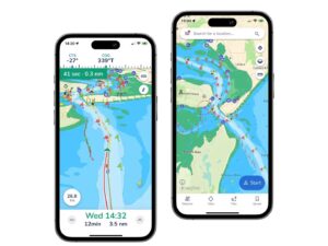
•Navionics Mobile Gold ($49.99). Navionics Gold XL9 presents seamless charts by region with tide, current, port services, and automatic updates.