It’s hard to remember what we did before the days of GPS. Even many of our cell phones these days are equipped with a GPS receiver — of course, they’re a drag on battery life. As such, boaters are wise to own a good, dedicated handheld when hitting the water. Here are three dandies.
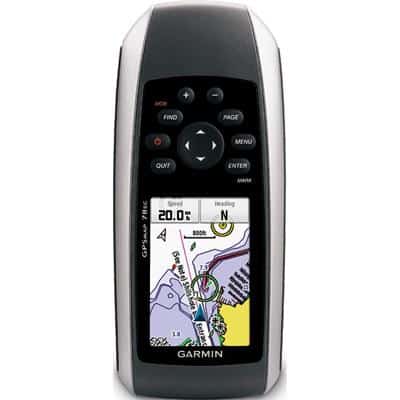
Garmin GPSMap 78sc
$550; garmin.com
What It Is: A 1.7 GB device that features a soft-key user interface, rubber side grips and a bright, 65 K color LCD display with backlight.
Weight: 7.7 ounces (with batteries) screen size: 1.6 x 2.2 inches
Battery Life: 20 hours (2 AAs)
Waterproof: Yes
What It Does: Offers a worldwide shaded-relief base map and a built-in microSD card slot for additional map data. The 78sc has the ability to store up to 2,000 waypoints and 200 routes, and it also offers wireless data transfer of tracks, waypoints and routes between compatible Garmin devices. Encased in a rugged, waterproof housing that floats.
Way Cool: A tri-axis, tilt-compensated electronic compass displays the heading — even when you’re standing still.
Selling Point: The 78sc is preloaded and ready to rock with BlueChart g2 marine cartography for the coastal United States.
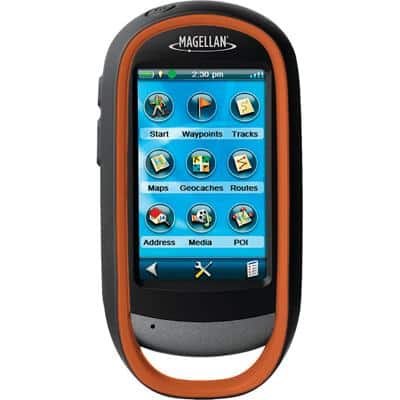
Magellan Explorist 710
$550; magellangps.com
What It Is: A rugged unit with 3 GB of usable storage, a color touch screen and two hard buttons that let you mark a waypoint — or take a photograph.
Weight: 6.87 ounces (without batteries) screen size: 3 inches
Battery Life: 16 hours (2 AAs)
Waterproof: Yes
What It Does: Comes preloaded with Magellan’s World Edition maps that include the road networks for more than 200 countries. Plus, it’s loaded with Magellan’s Summit Series topographic maps and its City Series maps, add-ons for many other Magellan GPS models. Accurate to three to five meters.
Way Cool: A OneTouch favorites menu lets you instantly access bookmarked locations — a great feature for your favorite fishing spots.
Selling Point: A built-in 3.2-megapixel camera with autofocus, microphone and speaker allows you to record geo-referenced images, videos and voice notes and then post to social-media sites from home.
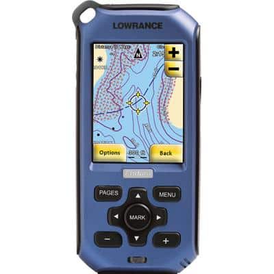
Lowrance Endura Sierra
$399; lowrance.com
What It Is: A device that contains more than 3 GB of mapping content and comes with a speaker, headphone jack, microphone and mini USB port.
Weight: 5.76 ounces (without batteries) screen size: 2.7 inches
Battery Life: 10 to 15 hours (2 AAs)
Waterproof: Yes
What It Does: Displays trip distance, altitude, trip times, current speed, average speed and time to destination on a color touch-screen hybrid interface. Preloaded content includes Intermap’s AccuTerra topographic maps, and a microSD expansion slot supports up to 32 GB of additional storage capacity.
Way Cool: A digital tri-axial compass functions in any position, and a builtin barometric altimeter offers pinpoint precision.
Selling Point: A version 1.4 software update is free at lowrance.com, and it makes the Sierra compatible with optional mapping content, including Fishing Hot Spots Pro USA and LakeMaster maps.