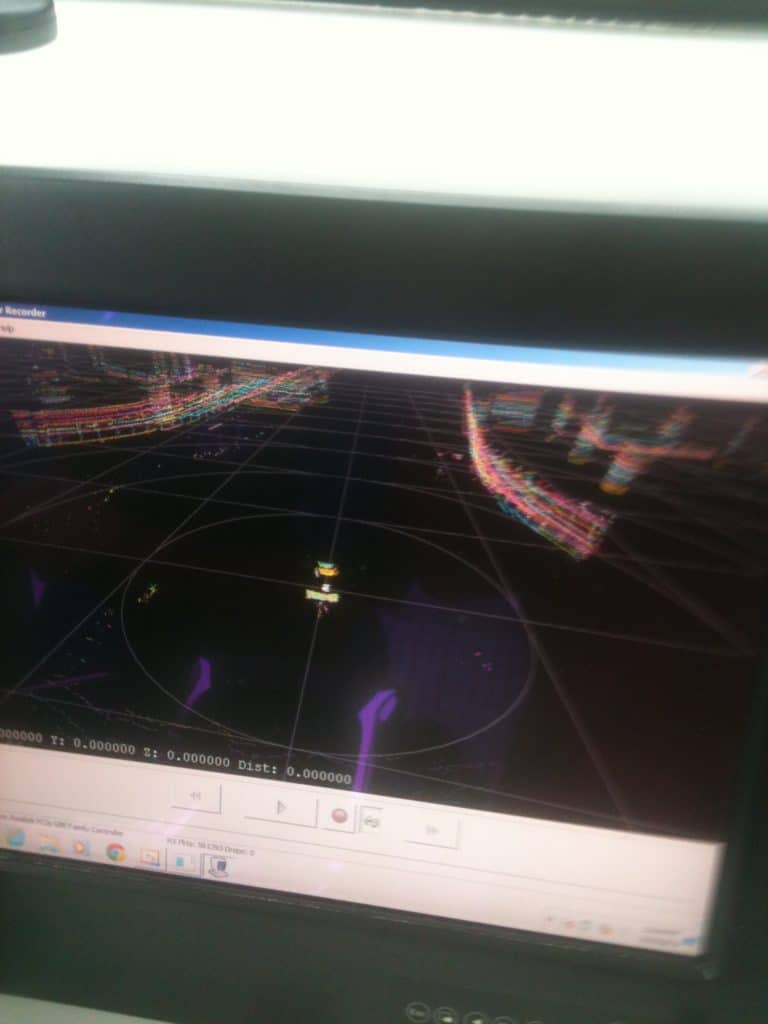
LIDAR virtual 3D image
We’ve all heard of marine electronics such as GPS, sonar and radar, but there might be a new super-navigational technology on the horizon for boaters.
It’s called LIDAR (Light Detection and Ranging), and I got to see it in action aboard the equally mind-blowing Velodyne Martini 1.5 in the waters off Miami, Florida. In addition to engineering gyro/pneumatic stabilization systems for boats such as the Martini 1.5, Morgan Hill, California-based Velodyne is developing LIDAR systems, with primary application intended for the emerging field of autonomously operated cars, and possibly autonomously navigated boats.
LIDAR also looks like a possible replacement for radar. It has a big advantage over radar, in that its lasers reflect better off non-metallic objects. Also LIDAR can see minute detail in objects at very close range and returns can be projected in a virtual 3D format. However, LIDAR is currently not as effective as marine radar at long-range target detection.
Velodyne decided to put one of its rapidly rotating, coffee-can-sized LIDAR sensors atop the Martini 1.5 with an LCD flat-panel display at the helm. The high-definition images it painted were more than amazing—they were the next best thing to seeing with my own eyes. Check out the image of the bridge abutments as we passed under the MacArthur Causeway east of Miami.
LIDAR was first employed in military applications, and some law enforcement agencies use simpler forms for speed detection in place of radar guns. Velodyne’s system is far more sophisticated.
The patented HDL-64E sensor shoots 64 lasers in rapid fire and measures backscattered light to update your surroundings at a rate of 1.3 million points per second. It has a 360-degree field of view with a 26.8-degree projection/reception angle. Velodyne is also developing technology that will blend with LIDAR images with GPS, mapping software and vision products such as FLIR to enhance the imagery.
From a pricing point of view, it is good news that Velodyne is targeting the automotive market, as such technology will no doubt be expensive. But economies of scale in the global car market might eventually bring down the cost of the system, making prices more attractive for everyone.
In the meantime, we’ll continue to rely on our chart plotters, radars, autopilots and our own eyes, which serve us just fine for now, thanks.