At 6:48 a.m. on Sept. 29, 2009, a massive 8.3 magnitude earthquake strikes midway between Samoa and American Samoa in the South Pacific.
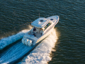
Approximately 120 miles from the quake’s epicenter, a group of boaters docked in Pago Pago Harbor in American Samoa are trying to make sense of the strange phenomenon taking place around them.
Wayne Hodges tells the others that he heard and felt a strange thrumming that he couldn’t quite identify. He estimates that the uncanny vibration lasted about three minutes. Soon another boater joins the group, announcing that he just checked the Internet and learned that there was a large undersea earthquake in the region nearly 20 minutes ago. As the conversation winds down and the cruisers disperse, one of them quips, “Watch out for a big wave.”
Moments later things turn more bizarre. As Hodges is about to step aboard his boat, it drops out from under him. The dock lines strain and screech under the load of the falling boat, eliciting a hum like guitar strings being overly tightened. The sound is amplified by other boats simultaneously experiencing the same ordeal as lines snap and cleats give way. Added to the cacophony is a peculiar sucking noise from the receding water. Hodges instinctively jumps aboard his boat and struggles to gain footing. Seconds later he looks down and is aghast to see…mud? The entire bay has been emptied of water.
Things get eerily silent. But it’s an ominous quiet. And it’s short-lived.
Tsunami! A thunderous flood of seawater re-enters the bay. Hodges sees some of the boaters running for a light post on an elevated section of the wharf. Another cruiser is standing on the dock feverishly trying to untie his lines. As Hodges’ boat rights itself, he unsheathes his knife and cuts the lines, freeing the vessel as it jostles in the rapidly rising, turbulent water. But Hodges’ boat rises up and over the dock, above what was dry land mere seconds ago. He watches in horror as the cruiser trying to undo his lines is swept away by the tsunami (to his death he learns later). The other boaters are clinging for their lives to the light post, climbing it higher and higher as the water rises. They survive.
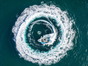
Hodges starts his engine and miraculously rides the tsunami out, successfully dodging other boats and large debris as he steers for deeper water, where he safely stays for the next three hours as successive tsunami waves come and go.
Hodges lived to boat another day. Many who are caught in a tsunami don’t. What can you do to increase your odds of survival if a tsunami has you in its sights?
Two things:
1. Seek knowledge. Become tsunami savvy.
2. Act quickly. Be ready to launch a plan of action without hesitation.

Improved Warning Systems
The National Oceanic and Atmospheric Administration (NOAA) bears the primary responsibility of providing tsunami warnings. Sadly, many of the major developments in establishing a reliable warning system have come in the wake of killer tsunamis. It seems disaster begets solution. For instance, a 7.8 earthquake in the Aleutian Islands in 1946 spawned a series of tsunamis that surged as high as 130 feet and took 165 lives. Interestingly only six died in Alaska — including five keepers at the Scotch Cap Lighthouse when the five-story steel-reinforced concrete structure was swept off Unimak Island by a 100-foot wave. The other 159 victims fell when the tsunami hit Hawaii largely unannounced nearly five hours later. This tragedy resulted in NOAA establishing the Seismic Sea Wave Warning System in Hawaii — the forerunner of the current Pacific Tsunami Warning System — in 1949.
NOAA created the West Coast/Alaska Tsunami Warning Center (WC/ATWC) in Palmer, Alaska, in 1967 as a direct result of the great 9.2 Alaska earthquake of 1964. Of 132 deaths, 122 were attributed to the Pacific-wide tsunami that generated a maximum wave height of 220 feet at Valdez Inlet in Prince William Sound. Today, the WC/ATWC continues to issue tsunami warnings for Alaska, British Columbia, Washington, Oregon and California.

In 2001 the National Weather Service developed the TsunamiReady program to help coastal communities better prepare for tsunamis. It works with community leaders and emergency administrators to develop plans that include evacuation routes and redundant systems of alerting the public. Choosing one of these harbors as your home base and including them as stopovers while cruising may improve your chances should a tsunami threat exist. Visit www.tsunamiready.noaa.gov/ts-communities.htm for a list of TsunamiReady sites.
Tsunami awareness reached new highs in December 2004 when a 9.1 magnitude earthquake struck off the coast of Sumatra. The series of killer tsunamis it unleashed claimed the lives of some 250,000 people — the highest tsunami death total on record. An onslaught of news reports and amateur videos ensured that tsunami became a household word overnight. It also underscored the need for an even better alert system since tens of thousands died without warning. The fact that the farthest tsunami victim was nearly 5,000 miles from the quake’s epicenter also highlighted the need for better worldwide communication. As a result, monitoring and communication systems improved. And they continue to get better year to year.
As good as tsunami warning systems have become, however, it takes a minimum of approximately five minutes before any warning can be issued. That’s how long it takes to gather the seismic information, assimilate the data, determine whether a tsunami is likely and then issue a warning if deemed necessary. Therefore, if you are in close proximity to a tsunami-generating earthquake, the tsunami may arrive before you receive an official warning. What can a boater do in cases like that?

Know the Signs
Wayne Hodges and the group of boaters in Pago Pago Harbor never received an “official” warning of the impending tsunami. But nature provided clues. Knowing how to read the signs, and acting on them, can be the difference between life and death.
The first clue of a tsunami threat was the earthquake. Although Hodges did not immediately recognize the “thrumming” to be from an earthquake (he initially thought it might be from the propellers of a freighter), it lasted long enough for him to ponder it and walk topside to investigate. When he saw the lampposts and telephone poles “swaying like blades of grass in a gentle breeze,” he realized it was an earthquake. But the duration of the quake should have told him that there was a real risk of a tsunami. Hodges estimated that the shaking lasted three minutes. Other boaters in the group described it as “an earthquake which seemed to have no end.” Any time you feel a coastal earthquake you should be concerned, but if it lasts more than 30 seconds, you should launch into automatic tsunami alert.
Being on tsunami alert doesn’t mean keeping an eye out for a big wave. If you’re in the harbor or on low-lying land, you should leave. Now. Train yourself to react without hesitation. You have two choices. One is to leave your boat at the dock and head for higher ground. Just going farther inland is not the answer though, unless you are gaining altitude. The tsunamis that hit Japan in March 2011 reached as high as 133 feet and inundated low-lying areas as far as six miles inland. You want elevation.
Your other option is to take the boat out to deep water. This is risky, however, especially if you do not know how close the quake’s epicenter is. The closer the epicenter, the less amount of time you have before a tsunami arrives. It could be mere minutes. In this case it is prudent to have pre-studied local charts to know water depths outside the harbor. According to the International Tsunami Information Center you should seek a depth of 1,200 feet. The state of Washington’s Boater Education Course says 600 feet with a preference of 1,200. It is when a tsunami hits shallow water that it builds in height. In deep water it passes as a mere ripple and can often go by unnoticed.
Another clue of nature is receding water, which often precedes the arrival of a tsunami. In the devastating 2004 Sumatra quake and tsunamis, many people saw the waters recede but did not know what it meant. Eyewitness reports testify that many victims leisurely walked out onto the exposed seafloor looking for sea life and trinkets. Children played in leftover pools of water. When the tsunami arrived they did not have time to escape. The time span between receding waters and the arrival of a tsunami can vary from minutes, as in Pago Pago Harbor, to nearly an hour. Also realize that tsunamis come in a series of waves and the first one is usually not the worst.

Earthquakes and tsunamis release unbelievable amounts of energy. Some additional natural signs that a tsunami may be imminent are odd sounds, weird vibrations and unusual water behavior. Hodges heard a thrumming. Others reported hearing a deep drone like that of helicopters in flight. Some have heard booms. Sometimes before a tsunami hits, the water gets frothy with bubbles and exhibits strange conflicting currents wherein moored vessels bob or sway violently. All of these are telltale signs that should not go unheeded.
Unlike hurricanes and volcanic eruptions, which can generally be predicted early on, no one knows when the next tsunami will come. But come it will. At this very moment, somewhere along the earth’s tectonic plates, the hammer is cocked and the trigger is being squeezed. And you may be in the cross hairs. So it’s prudent to become tsunami savvy, make sure you’re set up to receive alerts and have a game plan you can launch at a moment’s notice. Because that may be all the notice you get.

Tsunami Dynamics
The word tsunami comes from a Japanese word meaning “harbor wave.” Tsunamis are not caused by tides. Tsunamis can be generated by earthquakes, volcanic eruptions, landslides and meteorite impacts. Earthquakes of magnitude 7.0 and higher produce most tsunamis.
Tsunami waves come in a series. The distance between crests often exceeds 60 miles. They can travel at more than 500 mph. In deep water they may be only a few inches high at the surface and will pass beneath a boat undetected. When the waves approach shallow water, they slow down and build in height. A tsunami can hit shore as a huge wave hundreds of feet high. Most of the time, they arrive as a deadly, turbulent surge of whitewater.

Boater Be Warned
About one minute before the tsunami hit Pago Pago Harbor in 2009, I received three quick-succession text messages from the Tsunami Alarm System. The messages informed me that a major quake had occurred 19 minutes ago and that the risk of a tsunami near Samoa was high.
Although driving along the California coast, I knew more about the impending tsunami than Hodges, who in 60 seconds would experience it.
Don’t walk in Hodges’ shoes. You can get advance warning. Should an official tsunami alert be issued, you will be notified via e-mail and/or a text message if you subscribe to a service. Some are free, while others charge a fee. Here are a few we found.
Tsunami-Alarm-System.com
SMS (short message service) alert sent to mobile phone; $40 per year.
Tsunami-Warn.com
SMS alert sent to mobile phone; $29 per month.
CWarn.org
SMS alert sent to mobile phone; free.
ioc3.unesco.org/itic/contents.php?id=142
Sends alert via e-mail; free.
sslearthquake.usgs.gov/ens
Sends earthquake (not tsunami) notifications via e-mail and SMS text messages; free.
ptwc.weather.gov
Website you can access 24/7 for real-time status of any tsunami alerts. It does not send you an alert, but you can get data immediately and monitor alerts.
These sources are helpful only if you are in an area with Internet access or cell phone reception. You should also know and heed nature’s warning signs.
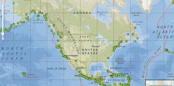
Likely Tsunami Locations
The “Ring of Fire” makes the Pacific Basin most vulnerable to tsunamis. But tsunamis strike in the Atlantic also, such as those at Rockaway Beach, New York, in 1884 and 1923, and in Puerto Rico in 1918. Scientists say a devastating tsunami potentially may occur when the Cumbre Vieja volcano on the island of La Palma, in the Canaries, crashes into the ocean, creating a wave that would inundate the U.S. East Coast. — Kevin Falvey
_
_
_
_