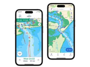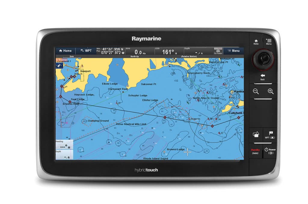
Jeppesen’s C-MAP 4D electronic cartography is now compatible with a wide range of Raymarine multifunction displays (including the new eS series MFDs), bringing boaters who use these products a host of innovative tools. One of the most remarkable is a navigational planning feature called “Easy Routing.”
As most boaters know, GPS will create a course to a waypoint, but sometimes it cuts directly through an island or point of land, forcing you to manually plot a route around such hazards.
Easy Routing, on the other hand, does this automatically. When enabled with C-MAP’s 4D MAX+ chart data (a feature you activate in the menu), it plots the shortest and safest course based on a vessel’s draft, beam and height, creating a route around a landmass, shoals and other fixed navigational hazards. You indicate where you want to go, and Easy Routing draws a safe route up to 100 nautical miles in length. It will also save the route for use on future trips.
C-MAP 4D is compatible with Raymarine MFDs sold after December 2011 but requires an upgrade to the latest LightHouse II operating software, available for free at raymarine.com. C-MAP 4D full-feature electronic cartography starts at $199.