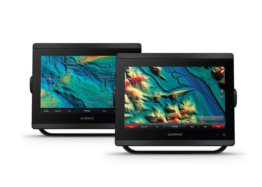
If you could drain the ocean and look at the seafloor without water, you’d see every reef, rock, ledge and wreck. You’d find uncharted, overlooked outcroppings, holes, and shards of structure that attract gobs of fish. The smallest of spots — often the most productive — would become readily apparent. While we can’t actually drain the ocean, a new generation of electronic high-resolution shaded-relief bathymetric cartography provides the next best thing.
Companies such as C-Map, CMOR Mapping, Garmin and others are rolling out this charting feature that, combining color and shadow, offers astoundingly detailed views of the ocean floor that can guide you to the mother lode.
“The best fishing spots are the ones that don’t show up on conventional charts,” says Erik Anderson, owner and CEO of CMOR Mapping. Shaded-relief electronic bathymetry, however, reveals the forgotten wrecks, isolated reefs, and ledges between the contour lines of conventional charts, Anderson explains.
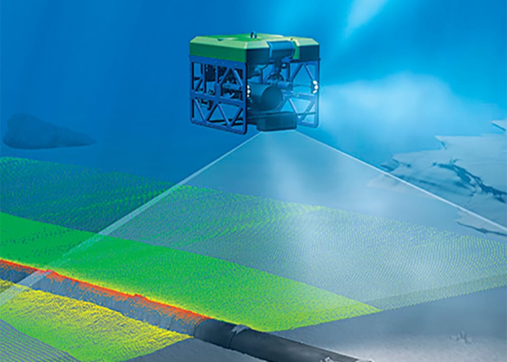
Nod to NOAA Shaded-relief bathymetry is derived largely from data gathered over many years of hydrographic surveys by the National Oceanographic and Atmospheric Administration and its sub agencies using sonar technology, like side-scan and multibeam soundings, cross-referenced with GPS and processed to create detailed maps of the ocean floor. Other data might be tapped in the creation of the shaded-relief electronic cartography emerging now, but NOAA represents the primary source.
This bathymetry data has been available for years. So, why are electronic charting entities just now adding this feature? “It’s not easy to process NOAA data for use in electronic charts,” says CMOR’s Anderson, a certified hydrographer with a master’s in marine science. His company, which started three years ago, has developed special software and algorithms to process the data-rich files for use in chart plotters. “It still takes time and many subjective interpretations of the data,” Anderson says. “But we are creating products that did not previously exist, and anglers love them. So, ultimately, sport fishermen are driving the market for high-resolution shaded-relief bathymetry.”
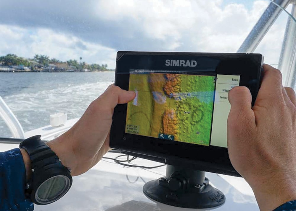
Newest Players The ramped-up consumer demand for this new genre of charting has not gone unnoticed by the heavy hitters in the marine electronics industry. At the 2019 Miami International Boat Show in February, two of the biggest names — Garmin and Navico — announced the addition of shaded-relief bathymetry features to their products. Garmin will make a high-res relief-shading feature available in its BlueChart g3 Vision accessory cards and downloads (compatible with Garmin products). Navico — parent company of Lowrance, Simrad and C-Map — will integrate a shaded-relief feature called SeaFloor into the new C-Map Max-N+ local chart cards (compatible with Navico products).
Navionics, owned by Garmin, is expected to offer some relief shading via its Platinum+ Marine electronic charts and Navionics subscriptions this year. And C-Map will roll out the SeaFloor feature in its 4D charts sometime in the future.
Timing Is Right Angler demand may be lending impetus to the development of shaded-relief charts today, yet this trend might not have been possible without the immense processing power of today’s multifunction displays.
“The processors and memories in MFDs have grown far more powerful than they were years ago, and so they can now easily manage a greater amount of data,” says Ken Cirillo, Garmin’s lead product manager for marine cartography and content. “Many older machines could not handle it.” That means that high-resolution shaded-relief cartography might not have operated very smoothly in the machines of yesteryear. “We’ve been talking about developing shaded-relief charting for years,” says Michael Kaste, program manager of charting for Navico. “But the demand from anglers for this kind of product has certainly accelerated development.”
Kaste echoes Cirillo’s opinion about processing data-rich charts. “About five years ago, the power in Lowrance and Simrad MFDs grew to the point where they could easily process charts with loads of data,” he reveals. “SeaFloor should not tax the processors.”
Expanding Coverage As companies work to develop and refine shaded-relief charts, much of the initial effort is focused on the most popular saltwater fishing regions — Florida, the upper Gulf of Mexico, and the Northeast. “CMOR already has much of Florida, the Gulf and Northeast done, and we’re finishing up the mid-Atlantic before moving on to the West Coast,” Anderson says. “We will do Southern California first, and then Alaska.”
C-Map and Garmin appear to be moving fast. The BlueChart g3 Vision accessory cards were scheduled to be available for all United States coastal waters by the first quarter of 2019. However, compatible Garmin MFDs will require a software upgrade in order to read the high-resolution relief shading.
The Max-N+ local charts from C-Map with the SeaFloor feature are scheduled to be available for 11 coastal areas, including regions in the Northeast, mid-Atlantic, Florida, the Bahamas, upper Gulf, mainland West Coast and Alaska. But as with CMOR, C-Map is starting with the key areas of Florida, the Gulf and the Eastern Seaboard, Kaste says.
Even once all the coastal areas are covered with high-resolution relief shading, enhancements to relief shading will continue, Cirillo says. “We plan to augment the data continuously with future updates,” he explains. One thing that shaded-relief bathymetry cannot show is bottom composition. “As the name implies, it is a virtual three-dimensional relief map, so it only depicts the changes in elevation of the ocean floor, albeit in remarkable detail,” Kaste says. It won’t tell you if the bottom is hard limestone or soft mud, but relief patterns can lead to inferences. For example, an abrupt, isolated high spot is likely composed of a hard substance such as rock or coral — structure that will certainly attract fish.
DockSense from FLIR/Raymarine uses artificial intelligence to recognize hazards when docking, and augments joystick control systems to prevent contact. DockSense employs five FLIR machine-vision cameras that sense distance as well as GPS to ensure a boat enters the dock without drama. FLIR/Raymarine is currently working with Mercury to introduce the system but has not yet announced pricing or availability. raymarine.com
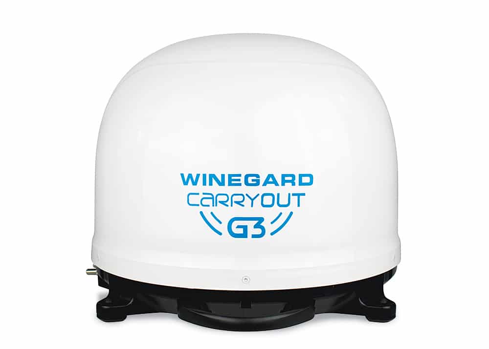
The Carryout G3 portable automatic satellite antenna from Winegard Co. enables boaters to easily enjoy their favorite TV programming through DISH Network (standard and HD) and DirecTV (standard) while relaxing in a marina or overnighting at anchor. Carryout G3 allows viewing a pair of TVs. The compact antenna weighs 7 pounds, making it easy to deploy and stow. $579 (excluding TV receiver); winegard.com
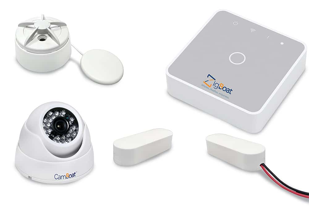
The ZigBoat security system from Glomex supplies vessel information when the boat is unattended. It delivers notifications without fees, subscriptions, registrations or privacy-policy agreements. The compact Gateway core module uses wireless sensors and accommodates an unlimited number, including motion, geofencing, and GPS tracking. ZigBoat standard package retails for $999, $1,399 for the pro kit; glomex.us