There’s an old saying you used to hear that states: “It’s not where you’re going, it’s how you get there.” With the speed and accuracy of today’s chart plotters, it seems like the “how” part of boating has never been easier.
But don’t let the ease of use of today’s navigation technology lull you into a false sense of security. At the very least, before you head out on a cruise where you will be relying on charting software, you should know how to read a chart. Let’s take a look at some of the basic symbols and numbers on charts and what they all mean.
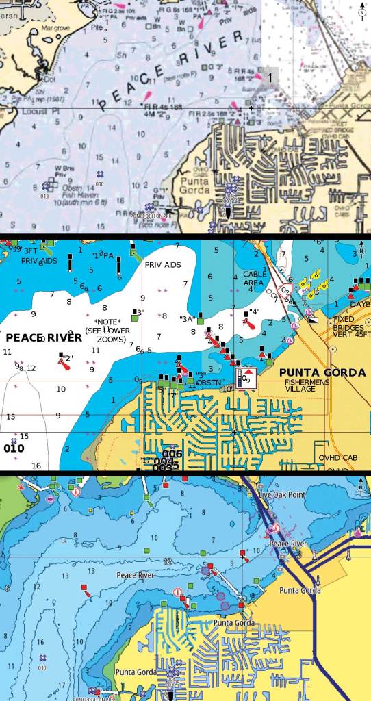
For the sake of simplicity, I’m going to focus on the official symbols found on the National Oceanic and Atmospheric Administration’s paper charts. Navigation companies scan these to appear on your plotter’s display as raster charts. For the more dynamic vector charts, some of the symbols, and the chart itself, might appear differently depending on the software provider.
True vs. Magnetic North
Perhaps the easiest thing to identify—and misuse—on every paper chart is the compass rose. It will typically display with an outer and inner ring. The outer ring will have a star at the top indicating true north, which is geographic north. However, the inner circle indicates magnetic north, the direction to the magnetic pole. The direction your electronic nav unit indicates is compass north, which is based on computing for local magnetic variation and the boat’s heading. (Aren’t you glad you no longer have to do this manually?) The direction that your boat’s compass—which every boat should have—points is not the same because offsets for deviation (affected by heading) and variation (affected by location) need to be manually accounted for. On the chart, magnetic north will have a smaller arrow pointing slightly off-kilter to the star that indicates true north. A boat’s compass might never match that of the compass rose.
Soundings
On your charts, you’ll see numbers aligned along a contour line that indicate the depth. It is important to know whether those numbers are measured in feet, fathoms or meters (1 fathom equals 6 feet), but that will be noted on the chart. In coastal waters, these depth measurements are for the mean low water (called mean lower low water on the West Coast), or the average depth recorded on the lowest tides over a 19-day period. So, the depth might be higher or lower than the printed number, depending on time and tide. In shallow areas, repeatedly check your sounder. In coastal and shoreline areas, some of the numbers might have dotted circles around them. These indicate rocks or other possible submerged hazards.
Distance and Scale
All fixed raster charts are drawn according to scale. Coastal charts are typically drawn in a 1-to-20,000 to 1-to-80,000 scale to show more detail. Navigable inland waterways, including the Great Lakes and major rivers, use statute miles, while coastal and offshore charts use nautical miles. A nautical mile is equal to one minute of latitude, which simplifies navigation computations. For comparison, 1 nautical mile equals 1.15 statute miles.
Aids to Navigation
On raster charts, you’ll see the simplified symbols found on NOAA paper charts. (Paper charts also can have black and white line drawings to show navaids.) For example, a floating green or red buoy will appear as a parallelogram in that color. A fixed major lateral beacon will be a vertical red or green rectangle. (A minor buoy would be a skinnier rectangle.) For a complete reference on the symbols on nautical charts, download NOAA’s free PDF US Chart No. 1 at nautical charts.noaa.gov/publications/us-chart-1.html.


