Mention the word radar and most boaters naturally think of collision avoidance. I have my own story about how radar saved me and my family while boating in the Pacific Northwest last summer, when a dense fog enveloped us midway across the Strait of Juan de Fuca. One minute we could see, and the next we were blind. A blip on the radar display indicated a fast-moving object heading directly toward us. After monitoring for a few minutes, I determined we were on a collision course and that the target was coming at us very fast. We cut speed and altered course, keeping our eyes glued to the radar screen to make sure we created enough space between us and whatever was inbound. A moment later, a fast-moving cruiser charged out of the swirling fog, flew past 50 yards off our bow and disappeared again in the cloud bank. Had it not been for radar, we probably would have collided.
I’m all about using radar for warning us about collision avoidance, which is the first thing that radar does better than other marine electronics. But radar can also do six other things that no other electronic navigation device (GPS, chart plotters and AIS) can do. Here’s the scoop, starting with a review course in the capabilities of navigation technology.

GPS
Global Positioning System is a multiple-satellite-based tracking system that receives a signal from an onboard GPS device, triangulates that information among a cluster of satellites and then returns information to you about your position. This is good for plotting your coordinates so they can be matched to a chart. With that information, you can determine where you are in relation to other things on the chart. It also indicates your heading and speed over ground and allows you to mark waypoints toward which you can navigate.
Chart Plotters
Chart Plotters are like GPS on steroids, showing your coordinates in relation to a digital chart. By using the cursor, you can plot waypoints, create a route and check coordinates of land features or aids to navigation (buoys, etc.). Some systems allow access to tide and current information and other bits of intel. The unfortunate truth about charts, whether paper or digital, is that they aren’t always accurate. They are a representation of things the way they’re supposed to be, but not necessarily as they really are. Explaining the reason for this would take a full discussion of cartography, which is beyond the scope of this article. Just realize that your GPS position on a chart is not necessarily a truthful representation of your actual distance from charted features.
AIS
Automatic Identification System is an active tracking system used on ships for transmitting their identity, position, course and speed. That’s useful information, but in order to access that information you must have an AIS receiver on board and the other vessel must be actively using an AIS transponder. Large commercial vessels are required to use AIS, but even though receivers are becoming popular on pleasure boats, very few have AIS transmitters. So, even if you have AIS on board, you won’t be able to see any boat that doesn’t operate a transmitter — like the boat that almost ran us down!
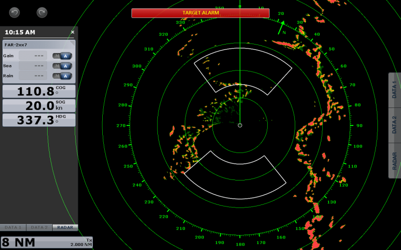
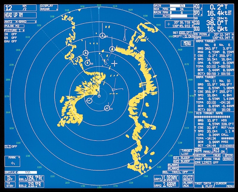
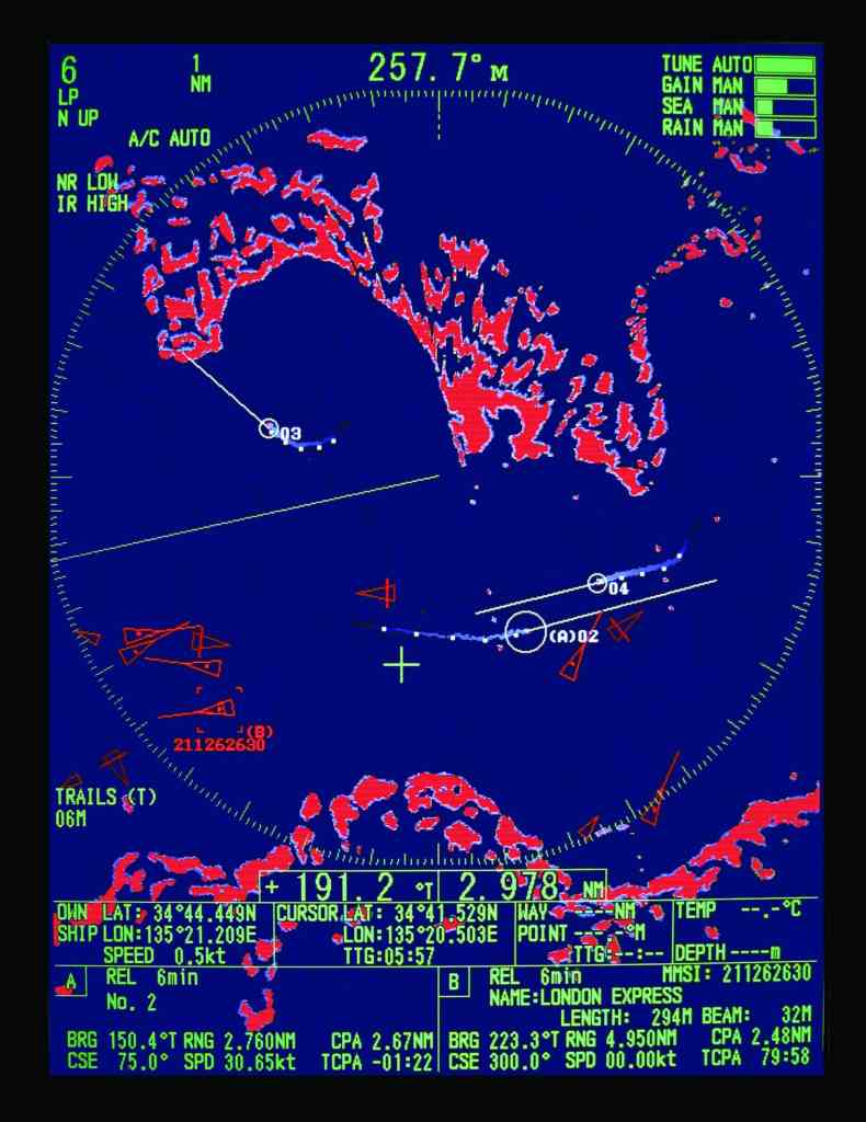
GPS, chart plotters and AIS are valuable for the limited functions they perform. Note, though, that none of them can help prevent a collision with uncharted objects (boats without AIS transmitters, floating debris, uncharted rocks, buoys that have drifted off station, etc.). Radar, on the other hand, doesn’t need the target to do anything except exist. Unlike AIS, it doesn’t require boats to transmit a signal for you to see them. Systems such as miniature automatic radar plotting aid (MARPA, also called ARPA — automatic radar plotting aid) allow you to identify a target, monitor its course and speed (as well as your course and speed in relation to the target), and identify the closest point of approach (CPA) and the time to the closest point of approach (TCPA). Danger alarms can be set to alert you if a target penetrates a guard zone that you establish around your boat. This combination of functions is the ultimate in collision avoidance technology.
See Where You Can’t
Now, let’s look at what radar can do for you that none of the other stuff can match. Let’s begin with the ability to see where you can’t. From the deck of your boat, the visible horizon is not very far. Let’s assume that, standing on deck, your eyeballs are 10 feet above the waterline. From that elevation, the visible edge of the earth on open sea is only 3.88 miles. The formula for calculating distance (in miles) to the apparent horizon is d=1.23 times the square root of the height (in feet) of your eyes above the water.
In contrast to that, radar can see over the horizon. The radar horizon is about 15 percent farther than the eyeball-visible horizon, because the radar’s microwaves are less subject to atmospheric deflection than the light that allows human eyes to see. In the above case, with you standing on the deck of your boat scanning the horizon, that 15 percent adds more than a half-mile. And because radar scanners are mounted higher than human eyeballs, the distance to detectable targets is increased even more.
Beyond a certain distance, human eyes will fail to be able to detect even large objects that are peeking above the horizon, but radar is not limited in the way eyeballs are. Let’s say a fast-moving boat with a flybridge height of 12 feet above the waterline is heading your way. Even though you might not be able to see it, a radar antenna mounted 10 feet above the waterline will be able to pick up that target at a range of 8 miles (more than double the distance to your visible horizon). Not only that, but radar will be able to track the target’s course and speed, so you can make collision avoidance decisions well in advance.
Do You Need a Heading Sensor?
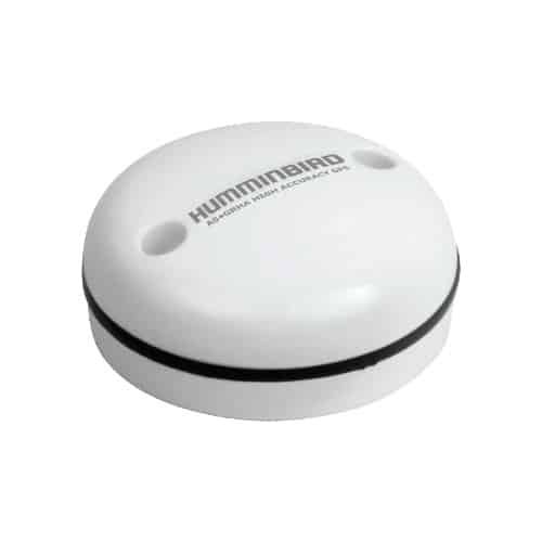
A heading sensor (such as this Humminbird AS GPS HS) is an electronic compass that updates a boat’s heading information faster than most GPS devices can, though some GPS antennas serve as heading sensors. Heading sensors can enhance the performance of radar, especially when using MARPA to track a painted target. They can also enhance the performance of autopilots and other marine electronics. A heading sensor is required if you want to create radar/chart plotter overlays.
See When You Can’t
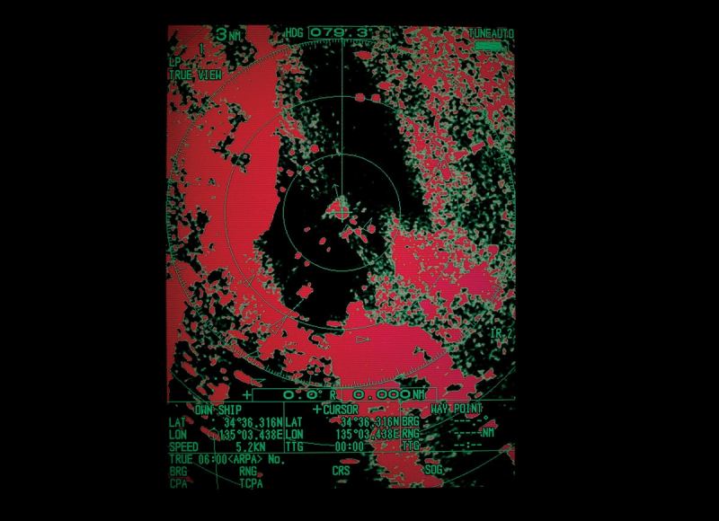
Visibility is compromised by darkness, fog (even a faint haze) and precipitation. This is when some boaters deceive themselves by thinking they’ll be safe as long as they follow their GPS or chart plotter route from waypoint to waypoint. The problem is that, when following a GPS or chart plotter route, it isn’t the charted land that will probably kill you — it’s the uncharted objects like other boats and floating debris that can send you to the bottom. This is when the superhero eyeballs of radar really earn their keep, seeing through visual obstructions to help you know what’s out there that you need to avoid.
Find a Fishing Spot
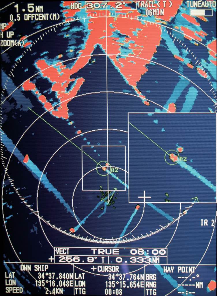
Let’s say you spot a target on your radar display, and it’s standing still or moving at trolling speed. You grab a binocular and scan the distant boat, recognizing it as a fishing vessel with lines in the water. Better yet is if there is a cluster of targets, all relatively motionless — a bunch of fishing buddies. As you watch, one fish after another is reeled aboard, and you know this is a hot spot you’ll want to remember. The most successful fish catchers keep their favorite spots secret, but you have a secret weapon of your own. If you know your own coordinates, you can use the radar VRM (variable range marker) and EBL (electronic bearing line) to determine the exact distance and direction to the target fishing boat. Then it’s easy to chart the coordinates of that prime fishing ground for future reference. Modern radar systems that are linked to your GPS also allow you to scroll the cursor over to the target and directly obtain a GPS coordinate for your new favorite fishing hole. While it’s true you could purloin a secret wreck from a boat equipped with — and broadcasting — AIS, with radar you can capture any distant vessel’s position.
Grab A Waypoint
That same technique can be used to grab a waypoint for any object that shows up on the radar screen. I once spotted an unknown target on the radar that turned out to be a dead whale floating on the surface. Using the radar functions, I was able to determine coordinates and relayed that information to the Coast Guard as a hazard to navigation.
Weather Alert (Squalls)
Radar sensitivity can be adjusted to indicate rain squalls in the distance, allowing you to analyze whether or not they are bearing down on your position. That might prompt you to batten down the hatches, take evasive action, and initiate whatever heavy-weather tactics you decide to use to keep your boat and your crew as safe as possible.
Enhanced Situational Awareness
On our boat, radar is used even during clear weather and bright sunshine, because it enhances situational awareness, alerting us to the fast boat overtaking from astern or coming from an obtuse angle. Without having my head on a swivel, constantly looking over my shoulder, the radar shows potential danger like no other navigation device.
Although radar has been around for more than 75 years, it’s still the best technology for marine collision avoidance, plus it has additional functions that can’t be matched by any other piece of marine electronics.
Glossary
Horizontal Beam Width
The angle of the radar transmission. A narrower HBW makes for better target resolution, better target separation and longer range. Objects within the horizontal beam width will paint on the screen, which helps guide installation location and angle.
Kilowatts (kW)
The output power of the radar set. More power can equal more range, generally, but other factors, such as horizontal beam width, apply. Also, newer digital radar has made this metric less meaningful since digital signal processing enhances radar target reception without the need for a lot of power.
MARPA/ARPA
A handy aid that highlights a specific target that a radar paints. While systems vary, basically you place the radar cursor over the target you wish to track and call up MARPA from a menu: The tracking and data display is automatic.
Open Array
An exposed radar antenna that rotates
Paint
A target that shows up on the radar screen is said to be “painted.” (My radar is painting the buoys clearly.)
Racon
An aid to navigation fitted with a transponder that causes an extraordinarily detailed target to paint (display) on the screen of a radar set
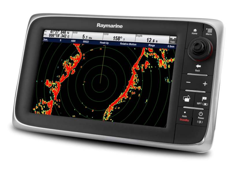
Radar
Radio detection and ranging
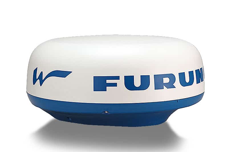
Radome
A radar antenna that rotates within a closed case, or dome
Target
An object that reflects microwaves transmitted by the radar and appears on the screen
Target Resolution
The ability of a radar to detect and display targets
Target Separation
The ability of a radar set to display (“paint”) individual targets that are close together as distinct and separate targets


